


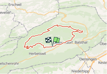
Tour VTT Bahlstahl

dondon
User

Length
30 km

Max alt
1206 m

Uphill gradient
961 m
Km-Effort
43 km

Min alt
488 m

Downhill gradient
964 m
Boucle
Yes
Creation date :
2014-12-11 00:00:00.0
Updated on :
2014-12-11 00:00:00.0
--
Difficulty : Unknown

FREE GPS app for hiking
 SityTrail
IGN / Geographical institutes
SityTrail Plus
The world is yours!
About
Trail Winter sports of 30 km to be discovered at Solothurn, Bezirk Thal, Matzendorf. This trail is proposed by dondon.
Description
Trimbach-Rotenfluh-Oberfrich...
Positioning
Country:
Switzerland
Region :
Solothurn
Department/Province :
Bezirk Thal
Municipality :
Matzendorf
Location:
Unknown
Start:(Dec)
Start:(UTM)
396343 ; 5240208 (32T) N.
Comments