


SityTrail - 28.09.2019 - De Baulon-ouest à Maxent

chasle
User
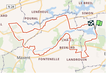

Length
28 km

Max alt
133 m

Uphill gradient
309 m
Km-Effort
32 km

Min alt
84 m

Downhill gradient
302 m
Boucle
Yes
Creation date :
2019-10-21 18:32:53.538
Updated on :
2019-11-10 10:31:35.318
6h38
Difficulty : Easy

FREE GPS app for hiking
 SityTrail
IGN / Geographical institutes
SityTrail Plus
The world is yours!
About
Trail Walking of 28 km to be discovered at Brittany, Ille-et-Vilaine, Baulon. This trail is proposed by chasle.
Positioning
Country:
France
Region :
Brittany
Department/Province :
Ille-et-Vilaine
Municipality :
Baulon
Location:
Unknown
Start:(Dec)
Start:(UTM)
578364 ; 5317332 (30U) N.
Comments