


bachason chabrinel

Joel26400
User
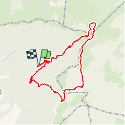

Length
18.4 km

Max alt
1677 m

Uphill gradient
976 m
Km-Effort
31 km

Min alt
1006 m

Downhill gradient
975 m
Boucle
Yes
Creation date :
2019-10-17 07:19:48.161
Updated on :
2019-10-22 15:27:21.162
6h58
Difficulty : Very difficult

FREE GPS app for hiking
 SityTrail
IGN / Geographical institutes
SityTrail Plus
The world is yours!
About
Trail Walking of 18.4 km to be discovered at Auvergne-Rhône-Alpes, Drôme, Romeyer. This trail is proposed by Joel26400.
Description
belle rando
Positioning
Country:
France
Region :
Auvergne-Rhône-Alpes
Department/Province :
Drôme
Municipality :
Romeyer
Location:
Unknown
Start:(Dec)
Start:(UTM)
693478 ; 4964362 (31T) N.
Comments