


Grusse

drarep
User
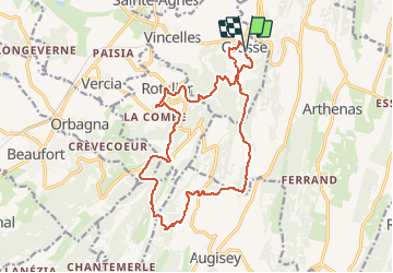

Length
17.5 km

Max alt
575 m

Uphill gradient
666 m
Km-Effort
26 km

Min alt
232 m

Downhill gradient
667 m
Boucle
Yes
Creation date :
2019-10-24 20:09:11.844
Updated on :
2019-12-21 18:02:52.598
6h44
Difficulty : Medium

FREE GPS app for hiking
 SityTrail
IGN / Geographical institutes
SityTrail Plus
The world is yours!
About
Trail Walking of 17.5 km to be discovered at Bourgogne-Franche-Comté, Jura, Val-Sonnette. This trail is proposed by drarep.
Positioning
Country:
France
Region :
Bourgogne-Franche-Comté
Department/Province :
Jura
Municipality :
Val-Sonnette
Location:
Unknown
Start:(Dec)
Start:(UTM)
691670 ; 5163414 (31T) N.
Comments