


lac de l'Abbaye GPX

drarep
User
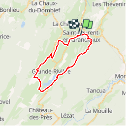

Length
22 km

Max alt
1028 m

Uphill gradient
431 m
Km-Effort
28 km

Min alt
851 m

Downhill gradient
429 m
Boucle
Yes
Creation date :
2019-10-24 20:41:37.848
Updated on :
2019-10-24 20:44:56.031
--
Difficulty : Medium

FREE GPS app for hiking
 SityTrail
IGN / Geographical institutes
SityTrail Plus
The world is yours!
About
Trail Walking of 22 km to be discovered at Bourgogne-Franche-Comté, Jura, Saint-Laurent-en-Grandvaux. This trail is proposed by drarep.
Positioning
Country:
France
Region :
Bourgogne-Franche-Comté
Department/Province :
Jura
Municipality :
Saint-Laurent-en-Grandvaux
Location:
Unknown
Start:(Dec)
Start:(UTM)
726376 ; 5162282 (31T) N.
Comments