


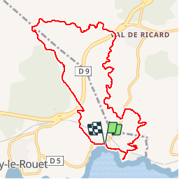
Le Rouet - plaine du Bon Jean

mhetpierre
User

Length
11.8 km

Max alt
168 m

Uphill gradient
261 m
Km-Effort
15.3 km

Min alt
4 m

Downhill gradient
260 m
Boucle
Yes
Creation date :
2019-10-25 07:47:54.461
Updated on :
2019-10-26 08:22:18.261
4h02
Difficulty : Very easy

FREE GPS app for hiking
 SityTrail
IGN / Geographical institutes
SityTrail Plus
The world is yours!
About
Trail Walking of 11.8 km to be discovered at Provence-Alpes-Côte d'Azur, Bouches-du-Rhône, Carry-le-Rouet. This trail is proposed by mhetpierre.
Positioning
Country:
France
Region :
Provence-Alpes-Côte d'Azur
Department/Province :
Bouches-du-Rhône
Municipality :
Carry-le-Rouet
Location:
Unknown
Start:(Dec)
Start:(UTM)
676330 ; 4800322 (31T) N.
Comments