


Journée 3

David JACQUET
User

Length
138 km

Max alt
2464 m

Uphill gradient
2550 m
Km-Effort
172 km

Min alt
1445 m

Downhill gradient
2554 m
Boucle
No
Creation date :
2019-10-25 06:09:04.0
Updated on :
2019-10-25 17:24:27.025
8h32
Difficulty : Unknown

FREE GPS app for hiking
 SityTrail
IGN / Geographical institutes
SityTrail Plus
The world is yours!
About
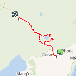
Trail 4x4 of 138 km to be discovered at Arusha. This trail is proposed by David JACQUET.
Positioning
Country:
Tanzania, United Republic of
Region :
Arusha
Department/Province :
Karatu District
Municipality :
Qurus
Location:
Unknown
Start:(Dec)
Start:(UTM)
792087 ; 9625790 (36M) S.
Comments