


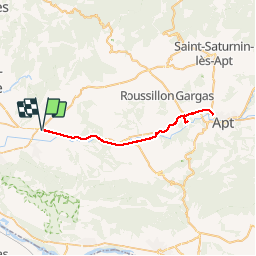
voie verte du Calavon - Coustellet - Apt A/R

fhascoet
User

Length
46 km

Max alt
236 m

Uphill gradient
311 m
Km-Effort
50 km

Min alt
104 m

Downhill gradient
311 m
Boucle
Yes
Creation date :
2019-10-27 09:36:40.056
Updated on :
2019-10-27 14:33:39.379
4h00
Difficulty : Very easy

FREE GPS app for hiking
 SityTrail
IGN / Geographical institutes
SityTrail Plus
The world is yours!
About
Trail Road bike of 46 km to be discovered at Provence-Alpes-Côte d'Azur, Vaucluse, Oppède. This trail is proposed by fhascoet.
Positioning
Country:
France
Region :
Provence-Alpes-Côte d'Azur
Department/Province :
Vaucluse
Municipality :
Oppède
Location:
Unknown
Start:(Dec)
Start:(UTM)
672721 ; 4859342 (31T) N.
Comments