


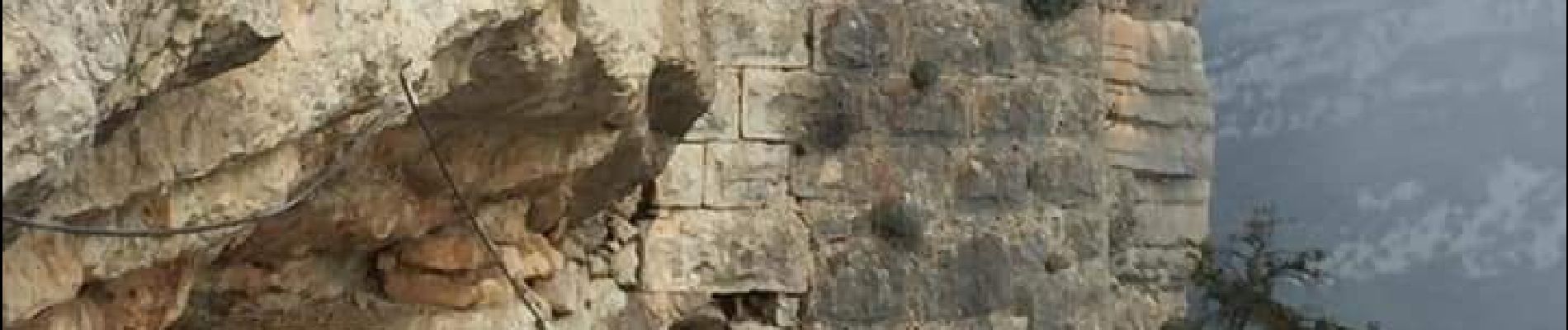
Gourdon-Forteresse de Cavillore

GrouGary
User
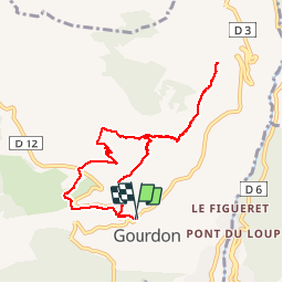

Length
8.9 km

Max alt
1055 m

Uphill gradient
441 m
Km-Effort
14.8 km

Min alt
737 m

Downhill gradient
440 m
Boucle
Yes
Creation date :
2019-10-29 07:38:26.843
Updated on :
2019-10-29 18:25:00.065
3h00
Difficulty : Very easy

FREE GPS app for hiking
 SityTrail
IGN / Geographical institutes
SityTrail Plus
The world is yours!
About
Trail Walking of 8.9 km to be discovered at Provence-Alpes-Côte d'Azur, Maritime Alps, Gourdon. This trail is proposed by GrouGary.
Description
Petite boucle et A/R à Forteresse
Court passage exposé près de la forteresse. A ne pas faire si vertige.
Photos


Positioning
Country:
France
Region :
Provence-Alpes-Côte d'Azur
Department/Province :
Maritime Alps
Municipality :
Gourdon
Location:
Unknown
Start:(Dec)
Start:(UTM)
337048 ; 4842917 (32T) N.
Comments