


Le Mont Doublier depuis Grasse

ETMU5496
User
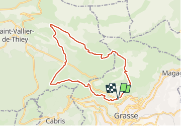

Length
18 km

Max alt
1227 m

Uphill gradient
760 m
Km-Effort
28 km

Min alt
539 m

Downhill gradient
760 m
Boucle
Yes
Creation date :
2019-10-30 07:49:20.0
Updated on :
2021-10-14 13:48:49.011
5h23
Difficulty : Medium

FREE GPS app for hiking
 SityTrail
IGN / Geographical institutes
SityTrail Plus
The world is yours!
About
Trail Walking of 18 km to be discovered at Provence-Alpes-Côte d'Azur, Maritime Alps, Grasse. This trail is proposed by ETMU5496.
Description
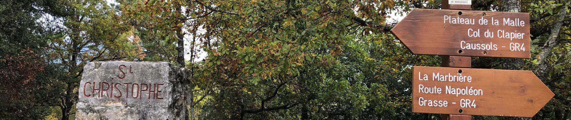
Belle randonnée sur les hauteurs de Grasse et sans difficultés particulières.
Photos


Positioning
Country:
France
Region :
Provence-Alpes-Côte d'Azur
Department/Province :
Maritime Alps
Municipality :
Grasse
Location:
Unknown
Start:(Dec)
Start:(UTM)
332211 ; 4836976 (32T) N.
Comments