


34 Frontignan Massif de la Gardiole

chris13370
User
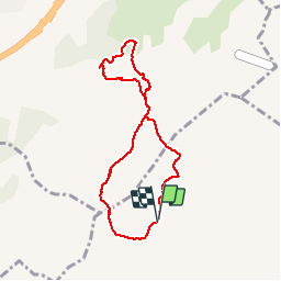

Length
7.5 km

Max alt
222 m

Uphill gradient
225 m
Km-Effort
10.5 km

Min alt
94 m

Downhill gradient
232 m
Boucle
Yes
Creation date :
2019-10-30 14:32:57.12
Updated on :
2019-10-30 17:11:44.654
2h00
Difficulty : Easy

FREE GPS app for hiking
 SityTrail
IGN / Geographical institutes
SityTrail Plus
The world is yours!
About
Trail Walking of 7.5 km to be discovered at Occitania, Hérault, Frontignan. This trail is proposed by chris13370.
Description
Depuis les hauteurs de Frontignan jolie boucle dans des vallons sauvages.
Panorama magnifique de Sète à Maguelonne et au-delà puis au retour sur l'étang de Thau et les parcs à huîtres.
Positioning
Country:
France
Region :
Occitania
Department/Province :
Hérault
Municipality :
Frontignan
Location:
Unknown
Start:(Dec)
Start:(UTM)
559519 ; 4813230 (31T) N.
Comments
Très jolie promenade un peu en dehors des grands circuits classiques de la Gardiole, donc plus tranquilles. Parfois les chemins sont un peu difficiles (très caillouteux dans les pentes) mais cela en vaut la peine .