


8932004-SL rouge

daniel_2w
User
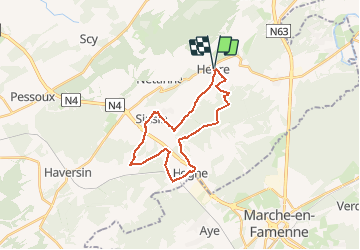

Length
22 km

Max alt
319 m

Uphill gradient
375 m
Km-Effort
27 km

Min alt
190 m

Downhill gradient
375 m
Boucle
Yes
Creation date :
2019-10-31 20:51:56.01
Updated on :
2020-11-23 12:15:06.305
--
Difficulty : Medium

FREE GPS app for hiking
 SityTrail
IGN / Geographical institutes
SityTrail Plus
The world is yours!
About
Trail Trail of 22 km to be discovered at Wallonia, Namur, Somme-Leuze. This trail is proposed by daniel_2w.
Description
Ce circuit vous emmène dans les villages de Sinsin et de Hogne entre routes de campagnes et chemins boisés. Un itinéraire pas trop technique dans un paysage campagnard.
Positioning
Country:
Belgium
Region :
Wallonia
Department/Province :
Namur
Municipality :
Somme-Leuze
Location:
Heure
Start:(Dec)
Start:(UTM)
663526 ; 5573899 (31U) N.
Comments