


Collobrières

jps13
User
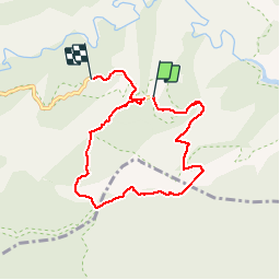

Length
7.5 km

Max alt
541 m

Uphill gradient
185 m
Km-Effort
9.9 km

Min alt
414 m

Downhill gradient
177 m
Boucle
No
Creation date :
2019-11-01 08:57:36.0
Updated on :
2019-11-01 11:10:38.46
1h34
Difficulty : Easy

FREE GPS app for hiking
 SityTrail
IGN / Geographical institutes
SityTrail Plus
The world is yours!
About
Trail Walking of 7.5 km to be discovered at Provence-Alpes-Côte d'Azur, Var, Collobrières. This trail is proposed by jps13.
Description
Ballade facile boucle tranquille dans les marronniers.
Positioning
Country:
France
Region :
Provence-Alpes-Côte d'Azur
Department/Province :
Var
Municipality :
Collobrières
Location:
Unknown
Start:(Dec)
Start:(UTM)
288998 ; 4790189 (32T) N.
Comments