


Le tholonet

Lobin
User
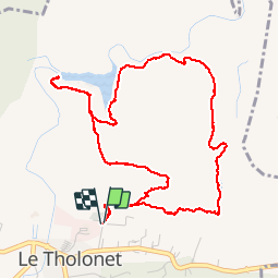

Length
5.9 km

Max alt
313 m

Uphill gradient
206 m
Km-Effort
8.6 km

Min alt
220 m

Downhill gradient
208 m
Boucle
Yes
Creation date :
2019-11-01 08:51:12.0
Updated on :
2019-11-01 11:11:17.777
1h58
Difficulty : Difficult

FREE GPS app for hiking
 SityTrail
IGN / Geographical institutes
SityTrail Plus
The world is yours!
About
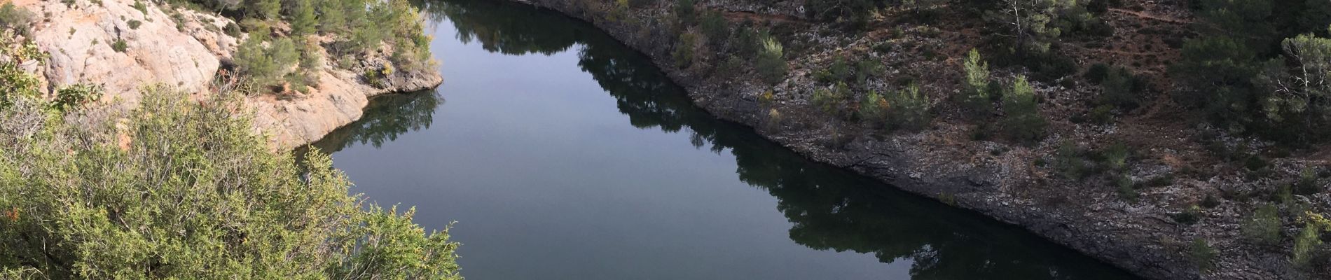
Trail Walking of 5.9 km to be discovered at Provence-Alpes-Côte d'Azur, Bouches-du-Rhône, Le Tholonet. This trail is proposed by Lobin.
Description
Belle randonnée facile avec les enfants
Photos

Positioning
Country:
France
Region :
Provence-Alpes-Côte d'Azur
Department/Province :
Bouches-du-Rhône
Municipality :
Le Tholonet
Location:
Unknown
Start:(Dec)
Start:(UTM)
703228 ; 4822053 (31T) N.
Comments