


Milpattes - 16092013
© OpenStreetMap contributors


2h17
Difficulty : Very easy


Length
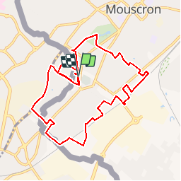
9.3 km
Max alt
47 m
Uphill gradient
76 m
Km-Effort
10.3 km
Min alt
24 m
Downhill gradient
73 m
Boucle
Yes
Creation date :
2014-12-10 00:00:00.0
Updated on :
2014-12-10 00:00:00.0
2h17
Difficulty : Very easy
FREE GPS app for hiking
 SityTrail
IGN / Geographical institutes
SityTrail Plus
The world is yours!
About
Trail Walking of 9.3 km to be discovered at Wallonia, Hainaut, Mouscron. This trail is proposed by jacques.moulin@hotmail.com.
Description
Le grand tour du Mont-à-leux en flirtant avec la frontière
Positioning
Country:
Belgium
Region :
Wallonia
Department/Province :
Hainaut
Municipality :
Mouscron
Location:
Mouscron
Start:(Dec)
Start:(UTM)
514163 ; 5620150 (31U) N.
Comments