


st eynard

Liebeaux
User
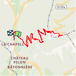

Length
7.3 km

Max alt
1324 m

Uphill gradient
635 m
Km-Effort
15.8 km

Min alt
770 m

Downhill gradient
637 m
Boucle
Yes
Creation date :
2019-11-07 07:57:19.206
Updated on :
2019-11-07 11:57:37.175
3h43
Difficulty : Very easy

FREE GPS app for hiking
 SityTrail
IGN / Geographical institutes
SityTrail Plus
The world is yours!
About
Trail Walking of 7.3 km to be discovered at Auvergne-Rhône-Alpes, Isère, Corenc. This trail is proposed by Liebeaux.
Positioning
Country:
France
Region :
Auvergne-Rhône-Alpes
Department/Province :
Isère
Municipality :
Corenc
Location:
Unknown
Start:(Dec)
Start:(UTM)
715930 ; 5012626 (31T) N.
Comments