


Le Senepy depuis les Merlins

cmarit
User
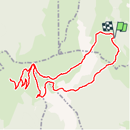

Length
11.6 km

Max alt
1766 m

Uphill gradient
633 m
Km-Effort
20 km

Min alt
1210 m

Downhill gradient
629 m
Boucle
Yes
Creation date :
2019-11-07 15:46:06.978
Updated on :
2019-11-09 08:52:36.653
--
Difficulty : Very easy

FREE GPS app for hiking
 SityTrail
IGN / Geographical institutes
SityTrail Plus
The world is yours!
About
Trail On foot of 11.6 km to be discovered at Auvergne-Rhône-Alpes, Isère, Susville. This trail is proposed by cmarit.
Description
il vaudrait probablement mieux la faire dans l'autre sens si on a les genoux fragiles!
On peut aussi aller en direction de la pierre plantée plutôt que de monter au Sénépy
Positioning
Country:
France
Region :
Auvergne-Rhône-Alpes
Department/Province :
Isère
Municipality :
Susville
Location:
Unknown
Start:(Dec)
Start:(UTM)
717538 ; 4977488 (31T) N.
Comments