


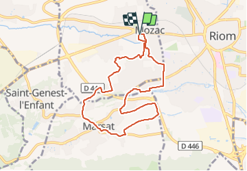
Mozac_Marsat

jagarnier
User GUIDE

Length
8.4 km

Max alt
388 m

Uphill gradient
74 m
Km-Effort
9.4 km

Min alt
347 m

Downhill gradient
74 m
Boucle
Yes
Creation date :
2019-11-11 06:18:40.029
Updated on :
2023-12-05 14:42:20.649
2h30
Difficulty : Easy

FREE GPS app for hiking
 SityTrail
IGN / Geographical institutes
SityTrail Plus
The world is yours!
About
Trail Walking of 8.4 km to be discovered at Auvergne-Rhône-Alpes, Puy-de-Dôme, Mozac. This trail is proposed by jagarnier.
Description
Sur les pas de Saint Calmin, cette balade à l'ouest de Riom (Puy de Dôme), entre Mozac et Marsat, mène à la découverte du patrimoine auvergnat.
Photos

Positioning
Country:
France
Region :
Auvergne-Rhône-Alpes
Department/Province :
Puy-de-Dôme
Municipality :
Mozac
Location:
Unknown
Start:(Dec)
Start:(UTM)
507215 ; 5082196 (31T) N.
Comments