


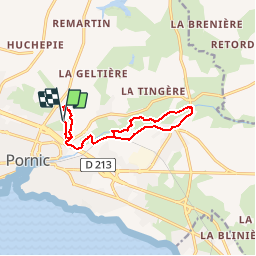
Pornic Canal de Haute Perche

Corsica76
User

Length
11.5 km

Max alt
22 m

Uphill gradient
95 m
Km-Effort
12.8 km

Min alt
-2 m

Downhill gradient
94 m
Boucle
Yes
Creation date :
2019-11-16 18:02:50.439
Updated on :
2019-11-16 18:04:03.598
--
Difficulty : Very easy

FREE GPS app for hiking
 SityTrail
IGN / Geographical institutes
SityTrail Plus
The world is yours!
About
Trail On foot of 11.5 km to be discovered at Pays de la Loire, Loire-Atlantique, Pornic. This trail is proposed by Corsica76.
Positioning
Country:
France
Region :
Pays de la Loire
Department/Province :
Loire-Atlantique
Municipality :
Pornic
Location:
Unknown
Start:(Dec)
Start:(UTM)
568907 ; 5219386 (30T) N.
Comments