


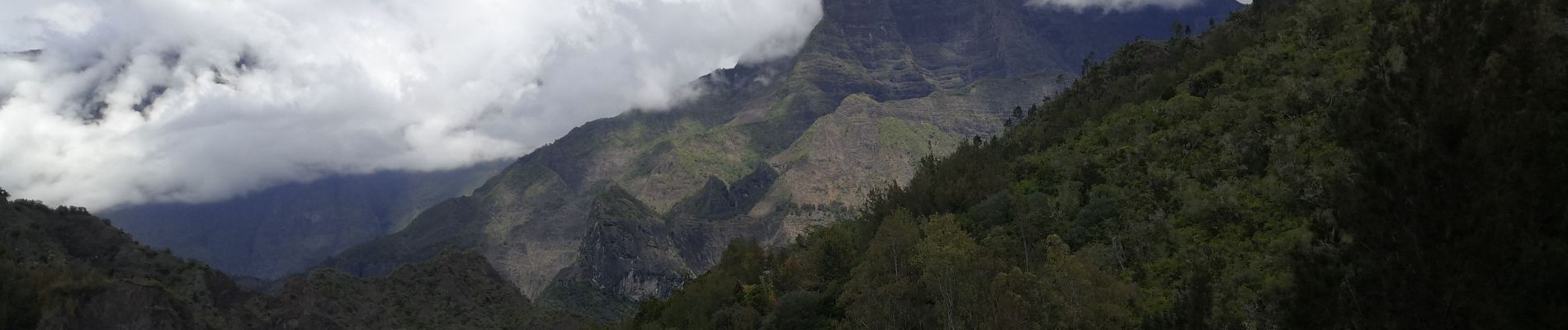
Cilaos Cascade bras rouge

Roulland
User
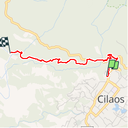

Length
3.2 km

Max alt
1246 m

Uphill gradient
93 m
Km-Effort
5.3 km

Min alt
920 m

Downhill gradient
367 m
Boucle
No
Creation date :
2019-11-17 05:39:57.001
Updated on :
2019-11-17 06:44:24.075
1h02
Difficulty : Medium

FREE GPS app for hiking
 SityTrail
IGN / Geographical institutes
SityTrail Plus
The world is yours!
About
Trail Walking of 3.2 km to be discovered at Réunion, Unknown, Cilaos. This trail is proposed by Roulland.
Photos


Positioning
Country:
France
Region :
Réunion
Department/Province :
Unknown
Municipality :
Cilaos
Location:
Unknown
Start:(Dec)
Start:(UTM)
341301 ; 7662446 (40K) S.
Comments