


Paris

ericlaurenty
User

Length
24 km

Max alt
118 m

Uphill gradient
293 m
Km-Effort
28 km

Min alt
36 m

Downhill gradient
278 m
Boucle
No
Creation date :
2019-11-17 12:33:04.0
Updated on :
2019-11-17 18:08:02.81
5h34
Difficulty : Unknown

FREE GPS app for hiking
 SityTrail
IGN / Geographical institutes
SityTrail Plus
The world is yours!
About
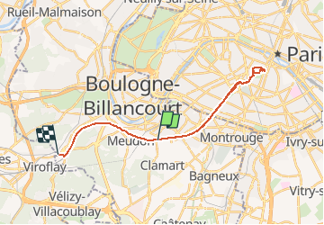
Trail Walking of 24 km to be discovered at Ile-de-France, Hauts-de-Seine, Clamart. This trail is proposed by ericlaurenty.
Positioning
Country:
France
Region :
Ile-de-France
Department/Province :
Hauts-de-Seine
Municipality :
Clamart
Location:
Unknown
Start:(Dec)
Start:(UTM)
445615 ; 5406930 (31U) N.
Comments