


Ourika

jcm17
User

Length
91 km

Max alt
1445 m

Uphill gradient
1007 m
Km-Effort
105 km

Min alt
451 m

Downhill gradient
1433 m
Boucle
No
Creation date :
2019-11-18 09:14:45.089
Updated on :
2019-11-18 17:20:46.324
4h06
Difficulty : Very easy

FREE GPS app for hiking
 SityTrail
IGN / Geographical institutes
SityTrail Plus
The world is yours!
About
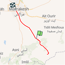
Trail Walking of 91 km to be discovered at Marrakech-Safi, Cercle de Tahannaout دائرة تحناوت, Ourika. This trail is proposed by jcm17.
Positioning
Country:
Morocco
Region :
Marrakech-Safi
Department/Province :
Cercle de Tahannaout دائرة تحناوت
Municipality :
Ourika
Location:
Unknown
Start:(Dec)
Start:(UTM)
614432 ; 3471196 (29R) N.
Comments