


Bron-Parilly réel 18 11 19-6.9 a 92 g0.5 d6

jtraverse
User
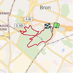


2h15
Difficulty : Easy

FREE GPS app for hiking
 SityTrail
IGN / Geographical institutes
SityTrail Plus
The world is yours!
About
Trail Walking of 6.9 km to be discovered at Auvergne-Rhône-Alpes, Métropole de Lyon, Bron. This trail is proposed by jtraverse.
Description
BRON - PARILLY Trajet voiture 6.0 km, 12 min
GPS Pk : 45.7226, 4.9135 ou 45°43'21.4"N 4°54'48.6"E
Adresse : Boulevard des Turfistes 69500 BRON
Trajet voiture : tourner à droite, au rond-point 3e sortie, descendre la Carnière, rejoindre l’Avenue Jean Jaurès, tourner 1e rue à droite rue Charles Ravat, puis 1e rue à gauche rue Jacques Reynaud
Tourner à droite Av Alfred de Vigny /Salvador Allende, remonter jusqu’après le Collège Gérard Philippe, tourner à gauche (rue Camille Desmoulins), puis 1e rue à droite (rue du Dauphiné),
Au bout de la route : Parc de Parilly, tourner à droite Bd de Parilly, suivre jusqu’au rond-point : 4e sortie pour entrer dans le Parc, tourner à droite en remontant le Bd des Turfistes, parking au niveau du portail d’accès au nord de l’hippodrome (chemin des Furets).
Positioning
Comments