


Braillans

eltonnermou
User

Length
9.1 km

Max alt
474 m

Uphill gradient
195 m
Km-Effort
11.7 km

Min alt
344 m

Downhill gradient
195 m
Boucle
Yes
Creation date :
2019-11-20 08:37:01.265
Updated on :
2019-12-29 11:29:31.55
1h24
Difficulty : Easy

FREE GPS app for hiking
 SityTrail
IGN / Geographical institutes
SityTrail Plus
The world is yours!
About
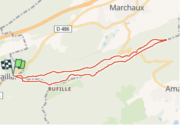
Trail Walking of 9.1 km to be discovered at Bourgogne-Franche-Comté, Doubs, Braillans. This trail is proposed by eltonnermou.
Description
randonnée pieds (presque) propres,
sentier de sous-bois avec 2 points de vue. Randonnée agréable d'hiver
Positioning
Country:
France
Region :
Bourgogne-Franche-Comté
Department/Province :
Doubs
Municipality :
Braillans
Location:
Unknown
Start:(Dec)
Start:(UTM)
280338 ; 5243612 (32T) N.
Comments