


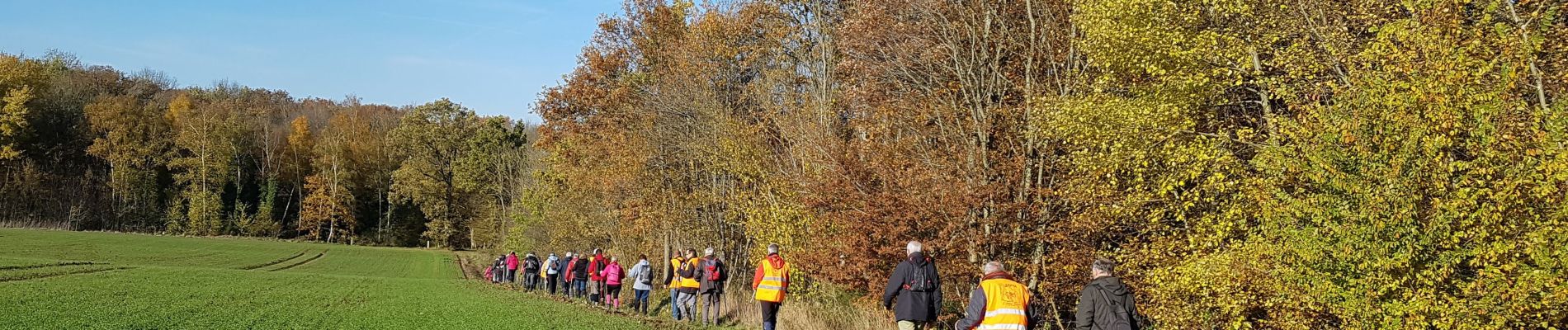
Bouresches du 22/11/2019

VANDERPUTTENMi
User GUIDE
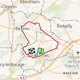

Length
10.6 km

Max alt
206 m

Uphill gradient
181 m
Km-Effort
13 km

Min alt
96 m

Downhill gradient
179 m
Boucle
Yes
Creation date :
2019-11-21 12:46:26.664
Updated on :
2019-11-22 17:14:24.147
2h57
Difficulty : Very easy

FREE GPS app for hiking
 SityTrail
IGN / Geographical institutes
SityTrail Plus
The world is yours!
About
Trail Walking of 10.6 km to be discovered at Hauts-de-France, Aisne, Bouresches. This trail is proposed by VANDERPUTTENMi.
Photos

Positioning
Country:
France
Region :
Hauts-de-France
Department/Province :
Aisne
Municipality :
Bouresches
Location:
Unknown
Start:(Dec)
Start:(UTM)
522529 ; 5434446 (31U) N.
Comments