


Circuit Batsère Sarlabous Escots Batsère

mitch1952
User
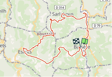

Length
12.4 km

Max alt
696 m

Uphill gradient
467 m
Km-Effort
18.7 km

Min alt
374 m

Downhill gradient
464 m
Boucle
Yes
Creation date :
2019-11-21 15:53:28.994
Updated on :
2022-06-01 19:24:55.393
3h53
Difficulty : Difficult

FREE GPS app for hiking
 SityTrail
IGN / Geographical institutes
SityTrail Plus
The world is yours!
About
Trail Walking of 12.4 km to be discovered at Occitania, Hautespyrenees, Batsère. This trail is proposed by mitch1952.
Positioning
Country:
France
Region :
Occitania
Department/Province :
Hautespyrenees
Municipality :
Batsère
Location:
Unknown
Start:(Dec)
Start:(UTM)
279215 ; 4771159 (31T) N.
Comments