


TRAIL JALABERT

laoj
User

Length
7.5 km

Max alt
111 m

Uphill gradient
137 m
Km-Effort
9.4 km

Min alt
57 m

Downhill gradient
141 m
Boucle
Yes
Creation date :
2019-11-27 14:48:18.545
Updated on :
2019-11-27 14:53:38.939
--
Difficulty : Very easy
--
Difficulty : Very easy

FREE GPS app for hiking
 SityTrail
IGN / Geographical institutes
SityTrail Plus
The world is yours!
About
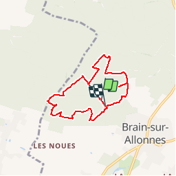
Trail Nordic walking of 7.5 km to be discovered at Pays de la Loire, Maine-et-Loire, Brain-sur-Allonnes. This trail is proposed by laoj.
Description
Circuit de TRAIL ou marche nordique autour du carrefour des six allées.
Positioning
Country:
France
Region :
Pays de la Loire
Department/Province :
Maine-et-Loire
Municipality :
Brain-sur-Allonnes
Location:
Unknown
Start:(Dec)
Start:(UTM)
277374 ; 5243757 (31T) N.
Comments