


Chapelle Saint-Quinis depuis Camps-la-Source

Nathy8913
User
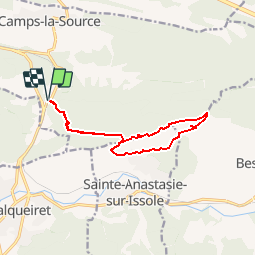

Length
12.4 km

Max alt
621 m

Uphill gradient
469 m
Km-Effort
18.7 km

Min alt
309 m

Downhill gradient
469 m
Boucle
Yes
Creation date :
2019-12-01 09:28:02.154
Updated on :
2019-12-01 09:30:48.372
--
Difficulty : Medium

FREE GPS app for hiking
 SityTrail
IGN / Geographical institutes
SityTrail Plus
The world is yours!
About
Trail On foot of 12.4 km to be discovered at Provence-Alpes-Côte d'Azur, Var, Camps-la-Source. This trail is proposed by Nathy8913.
Points of interest


Positioning
Country:
France
Region :
Provence-Alpes-Côte d'Azur
Department/Province :
Var
Municipality :
Camps-la-Source
Location:
Unknown
Start:(Dec)
Start:(UTM)
264676 ; 4805463 (32T) N.
Comments