


Les Vieillettes Cauterets

ARVIEU
User

Length
20 km

Max alt
2254 m

Uphill gradient
1333 m
Km-Effort
38 km

Min alt
1009 m

Downhill gradient
1299 m
Boucle
No
Creation date :
2019-12-01 11:06:21.68
Updated on :
2019-12-01 11:08:21.798
7h00
Difficulty : Difficult

FREE GPS app for hiking
 SityTrail
IGN / Geographical institutes
SityTrail Plus
The world is yours!
About
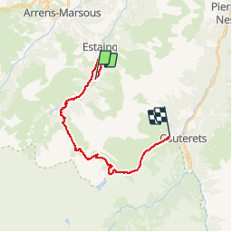
Trail On foot of 20 km to be discovered at Occitania, Hautespyrenees, Estaing. This trail is proposed by ARVIEU.
Description
Lac d Estaing Abri Barbât col d Aheou col d Ilheou Cauterets
Positioning
Country:
France
Region :
Occitania
Department/Province :
Hautespyrenees
Municipality :
Estaing
Location:
Unknown
Start:(Dec)
Start:(UTM)
730008 ; 4756009 (30T) N.
Comments