


gt

Dirk242
User
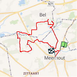

Length
17.2 km

Max alt
39 m

Uphill gradient
122 m
Km-Effort
18.8 km

Min alt
17 m

Downhill gradient
116 m
Boucle
No
Creation date :
2019-12-01 09:43:02.286
Updated on :
2019-12-01 13:44:34.71
4h01
Difficulty : Very easy

FREE GPS app for hiking
 SityTrail
IGN / Geographical institutes
SityTrail Plus
The world is yours!
About
Trail Walking of 17.2 km to be discovered at Flanders, Antwerp, Meerhout. This trail is proposed by Dirk242.
Description
Bos en heide
Positioning
Country:
Belgium
Region :
Flanders
Department/Province :
Antwerp
Municipality :
Meerhout
Location:
Meerhout
Start:(Dec)
Start:(UTM)
645749 ; 5667066 (31U) N.
Comments