


Bagnols - La lieutenante

Sugg
User
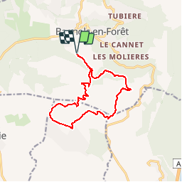

Length
13.9 km

Max alt
351 m

Uphill gradient
386 m
Km-Effort
19 km

Min alt
87 m

Downhill gradient
386 m
Boucle
Yes
Creation date :
2019-12-02 17:20:03.151
Updated on :
2019-12-02 17:24:03.799
4h02
Difficulty : Difficult

FREE GPS app for hiking
 SityTrail
IGN / Geographical institutes
SityTrail Plus
The world is yours!
About
Trail Walking of 13.9 km to be discovered at Provence-Alpes-Côte d'Azur, Var, Bagnols-en-Forêt. This trail is proposed by Sugg.
Description
Parcours de remplacement ( suite innondations )pour la sortie du 4 décembre 2019.
Positioning
Country:
France
Region :
Provence-Alpes-Côte d'Azur
Department/Province :
Var
Municipality :
Bagnols-en-Forêt
Location:
Unknown
Start:(Dec)
Start:(UTM)
313414 ; 4822226 (32T) N.
Comments