


hockay 4-12-19

BoulangerPierre
User GUIDE
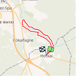

Length
10 km

Max alt
551 m

Uphill gradient
245 m
Km-Effort
13.2 km

Min alt
362 m

Downhill gradient
246 m
Boucle
Yes
Creation date :
2019-12-04 12:34:13.073
Updated on :
2019-12-04 17:35:52.019
2h25
Difficulty : Very easy

FREE GPS app for hiking
 SityTrail
IGN / Geographical institutes
SityTrail Plus
The world is yours!
About
Trail Walking of 10 km to be discovered at Wallonia, Liège, Stavelot. This trail is proposed by BoulangerPierre.
Photos

Positioning
Country:
Belgium
Region :
Wallonia
Department/Province :
Liège
Municipality :
Stavelot
Location:
Francorchamps
Start:(Dec)
Start:(UTM)
711855 ; 5596466 (31U) N.
Comments