diagonale 2013

mikaelerouzic
User
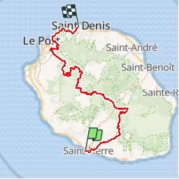

Length
161 km

Max alt
2202 m

Uphill gradient
9576 m
Km-Effort
288 km

Min alt
6 m

Downhill gradient
9543 m
Boucle
No
Creation date :
2016-03-09 00:00:00.0
Updated on :
2016-03-09 00:00:00.0
30h00
Difficulty : Very difficult

FREE GPS app for hiking
 SityTrail
IGN / Geographical institutes
SityTrail Plus
The world is yours!
About
Trail Running of 161 km to be discovered at Réunion, Unknown, Saint-Pierre. This trail is proposed by mikaelerouzic.
Positioning
Country:
France
Region :
Réunion
Department/Province :
Unknown
Municipality :
Saint-Pierre
Location:
Unknown
Start:(Dec)
Start:(UTM)
341151 ; 7639659 (40K) S.
Comments