


st roch

Mascart
User
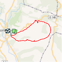

Length
6.5 km

Max alt
321 m

Uphill gradient
178 m
Km-Effort
8.8 km

Min alt
153 m

Downhill gradient
176 m
Boucle
Yes
Creation date :
2019-12-08 13:17:41.3
Updated on :
2019-12-08 15:44:14.496
2h19
Difficulty : Very easy

FREE GPS app for hiking
 SityTrail
IGN / Geographical institutes
SityTrail Plus
The world is yours!
About
Trail Walking of 6.5 km to be discovered at Occitania, Aude, Montolieu. This trail is proposed by Mascart.
Description
Boucle
Positioning
Country:
France
Region :
Occitania
Department/Province :
Aude
Municipality :
Montolieu
Location:
Unknown
Start:(Dec)
Start:(UTM)
436650 ; 4795236 (31T) N.
Comments