


Cauterets Baysselance

ARVIEU
User
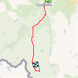

Length
19 km

Max alt
2738 m

Uphill gradient
1860 m
Km-Effort
38 km

Min alt
940 m

Downhill gradient
172 m
Boucle
No
Creation date :
2019-12-08 20:48:24.112
Updated on :
2019-12-08 20:49:37.504
9h30
Difficulty : Difficult

FREE GPS app for hiking
 SityTrail
IGN / Geographical institutes
SityTrail Plus
The world is yours!
About
Trail On foot of 19 km to be discovered at Occitania, Hautespyrenees, Cauterets. This trail is proposed by ARVIEU.
Positioning
Country:
France
Region :
Occitania
Department/Province :
Hautespyrenees
Municipality :
Cauterets
Location:
Unknown
Start:(Dec)
Start:(UTM)
735731 ; 4752229 (30T) N.
Comments