


SityTrail - M2 haut de montaner depuis tarasteix 7k d100

mitch1952
User
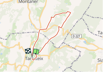

Length
6.8 km

Max alt
355 m

Uphill gradient
99 m
Km-Effort
8.1 km

Min alt
272 m

Downhill gradient
99 m
Boucle
Yes
Creation date :
2019-12-10 17:22:34.465
Updated on :
2022-06-01 19:23:08.288
1h50
Difficulty : Medium

FREE GPS app for hiking
 SityTrail
IGN / Geographical institutes
SityTrail Plus
The world is yours!
About
Trail Walking of 6.8 km to be discovered at Occitania, Hautespyrenees, Tarasteix. This trail is proposed by mitch1952.
Positioning
Country:
France
Region :
Occitania
Department/Province :
Hautespyrenees
Municipality :
Tarasteix
Location:
Unknown
Start:(Dec)
Start:(UTM)
742778 ; 4800816 (30T) N.
Comments