


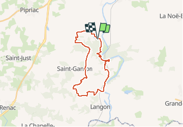
21.10.2013 - Étang BARON... port de Roche...

babeth35
User

Length
25 km

Uphill gradient
1371 m
Km-Effort
43 km

Downhill gradient
1319 m
Boucle
Yes
Creation date :
2014-12-10 00:00:00.0
Updated on :
2020-07-20 16:11:23.96
5h35
Difficulty : Medium

FREE GPS app for hiking
 SityTrail
IGN / Geographical institutes
SityTrail Plus
The world is yours!
About
Trail Walking of 25 km to be discovered at Brittany, Ille-et-Vilaine, Guipry-Messac. This trail is proposed by babeth35.
Positioning
Country:
France
Region :
Brittany
Department/Province :
Ille-et-Vilaine
Municipality :
Guipry-Messac
Location:
Guipry
Start:(Dec)
Start:(UTM)
585925 ; 5292687 (30T) N.
Comments