Trail Walking Saint-Saturnin - 
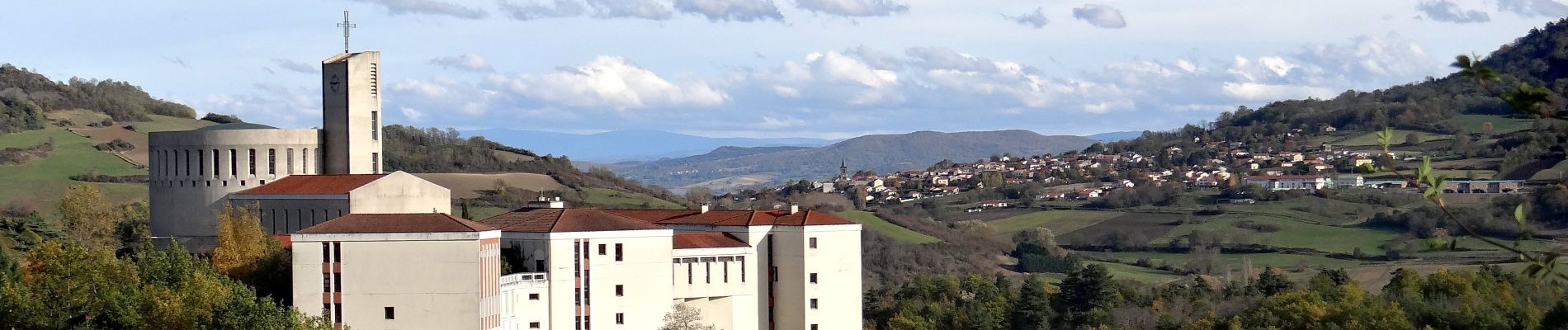
St_Saturnin_Randol_2 - Photo
 jagarnier
jagarnier

User GUIDE

© OpenStreetMap contributors
Length
Length
15.4 km
Max alt
Max alt
769 m
Uphill gradient
Uphill gradient
388 m
Km-Effort
Km-Effort  
21 km
Min alt
Min alt
507 m
Downhill gradient
Downhill gradient
389 m
Boucle
Boucle
Yes
Creation date :
2019-12-13 08:28:06.105
Updated on :
2023-12-24 13:57:18.552

(0 Reviews)

Walking
Walking
4h30
Difficulty : Medium

Scan this QR Code to open this trail in the SityTrail application

FREE GPS app for hiking

Logo SityTrail SityTrail

IGN / Geographical institutes

Download SityTrail from the App Store Download SityTrail from Google Play

Logo SityTrail SityTrail Plus

The world is yours!

Download SityTrail from the App Store Download SityTrail from Google Play Download SityTrail on Huawei AppGallery

About

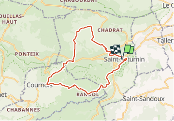
Trail Walking of 15.4 km to be discovered at Auvergne-Rhône-Alpes, Puy-de-Dôme, Saint-Saturnin. This trail is proposed by jagarnier.

Description

Cette randonnée permet de traverser Saint-Saturnin, village remarquable construit en pierres blondes, ce qui lui donne une atmosphère méridionale. Le long de fontaines, église romane, château fort, l'itinéraire se poursuit en surplomb du village.

Elevation profile

Photos

Positioning

Country:
France
Region :
Auvergne-Rhône-Alpes
Department/Province :
Puy-de-Dôme
Municipality :
Saint-Saturnin
Location:
Unknown
Start:(UTM)
507073 ; 5056219 (31T) N.


Close
My subscriptions