


cornillon.amis

NADINE52
User
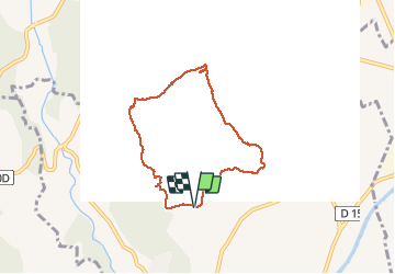

Length
6.5 km

Max alt
90 m

Uphill gradient
66 m
Km-Effort
7.4 km

Min alt
56 m

Downhill gradient
64 m
Boucle
Yes
Creation date :
2019-12-14 08:28:44.888
Updated on :
2019-12-14 10:52:59.714
2h23
Difficulty : Very easy

FREE GPS app for hiking
 SityTrail
IGN / Geographical institutes
SityTrail Plus
The world is yours!
About
Trail Walking of 6.5 km to be discovered at Provence-Alpes-Côte d'Azur, Bouches-du-Rhône, Cornillon-Confoux. This trail is proposed by NADINE52.
Positioning
Country:
France
Region :
Provence-Alpes-Côte d'Azur
Department/Province :
Bouches-du-Rhône
Municipality :
Cornillon-Confoux
Location:
Unknown
Start:(Dec)
Start:(UTM)
667268 ; 4827275 (31T) N.
Comments