


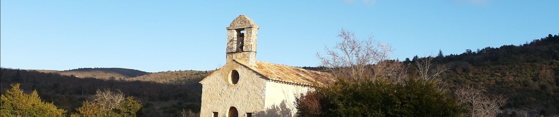
Chapelle st foy

FLORENSAC
User
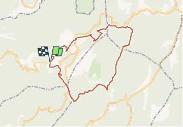

Length
17.9 km

Max alt
888 m

Uphill gradient
564 m
Km-Effort
25 km

Min alt
552 m

Downhill gradient
565 m
Boucle
Yes
Creation date :
2019-12-15 08:48:17.824
Updated on :
2019-12-15 14:33:49.138
5h43
Difficulty : Very easy

FREE GPS app for hiking
 SityTrail
IGN / Geographical institutes
SityTrail Plus
The world is yours!
About
Trail Walking of 17.9 km to be discovered at Provence-Alpes-Côte d'Azur, Vaucluse, Méthamis. This trail is proposed by FLORENSAC.
Photos

Positioning
Country:
France
Region :
Provence-Alpes-Côte d'Azur
Department/Province :
Vaucluse
Municipality :
Méthamis
Location:
Unknown
Start:(Dec)
Start:(UTM)
682435 ; 4875305 (31T) N.
Comments