


Le Mollard depart gendarmerie

claude nier
User
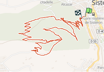

Length
5.7 km

Max alt
738 m

Uphill gradient
282 m
Km-Effort
9.4 km

Min alt
509 m

Downhill gradient
275 m
Boucle
Yes
Creation date :
2019-12-16 07:34:29.67
Updated on :
2019-12-16 19:10:25.16
2h16
Difficulty : Easy

FREE GPS app for hiking
 SityTrail
IGN / Geographical institutes
SityTrail Plus
The world is yours!
About
Trail Walking of 5.7 km to be discovered at Provence-Alpes-Côte d'Azur, Alpes-de-Haute-Provence, Sisteron. This trail is proposed by claude nier.
Description
andre,jeanine,joseph,michelle et moi
Positioning
Country:
France
Region :
Provence-Alpes-Côte d'Azur
Department/Province :
Alpes-de-Haute-Provence
Municipality :
Sisteron
Location:
Unknown
Start:(Dec)
Start:(UTM)
735066 ; 4897715 (31T) N.
Comments