


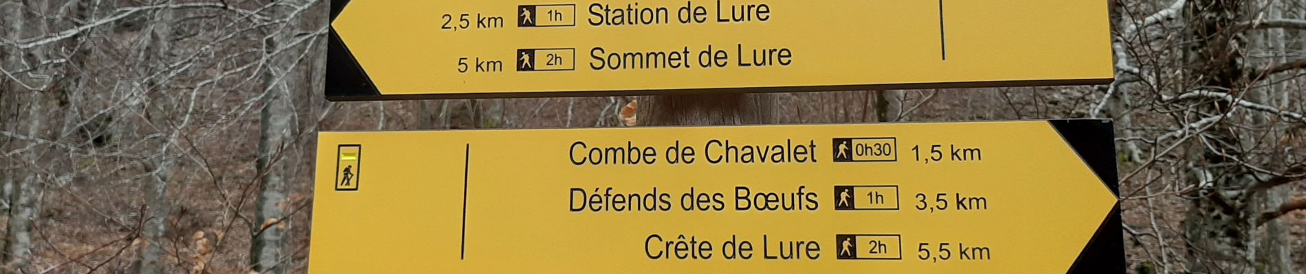
CRUIS . Jas Roche . Combe de Chevalet . ND de Lure o

RobinMicheline
User GUIDE
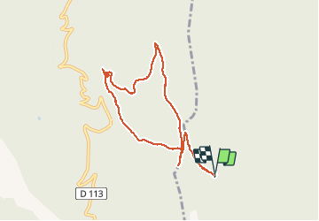

Length
9 km

Max alt
1351 m

Uphill gradient
356 m
Km-Effort
13.8 km

Min alt
1045 m

Downhill gradient
352 m
Boucle
Yes
Creation date :
2019-12-16 09:41:52.104
Updated on :
2019-12-22 17:01:35.142
4h00
Difficulty : Easy

FREE GPS app for hiking
 SityTrail
IGN / Geographical institutes
SityTrail Plus
The world is yours!
About
Trail Walking of 9 km to be discovered at Provence-Alpes-Côte d'Azur, Alpes-de-Haute-Provence, Cruis. This trail is proposed by RobinMicheline.
Description
Belle foret de fayards et magnifique chapelle ND de Lure possibilite de faire avec la ronde des Jas
Photos


Positioning
Country:
France
Region :
Provence-Alpes-Côte d'Azur
Department/Province :
Alpes-de-Haute-Provence
Municipality :
Cruis
Location:
Unknown
Start:(Dec)
Start:(UTM)
725238 ; 4884892 (31T) N.
Comments