


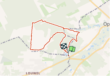
Opoeteren: rond Oudsberg

bometdehamer
User

Length
7.7 km

Max alt
89 m

Uphill gradient
79 m
Km-Effort
8.7 km

Min alt
58 m

Downhill gradient
81 m
Boucle
Yes
Creation date :
2019-12-20 12:18:08.0
Updated on :
2019-12-20 14:29:21.701
2h00
Difficulty : Easy

FREE GPS app for hiking
 SityTrail
IGN / Geographical institutes
SityTrail Plus
The world is yours!
About
Trail Walking of 7.7 km to be discovered at Flanders, Limburg, Maaseik. This trail is proposed by bometdehamer.
Description
Uitgestippelde wandeling, blauwe ruit. Ik vertrek op camping Zavelbos. Mooie wandeling.
Photos


Positioning
Country:
Belgium
Region :
Flanders
Department/Province :
Limburg
Municipality :
Maaseik
Location:
Opoeteren
Start:(Dec)
Start:(UTM)
684192 ; 5659514 (31U) N.
Comments