


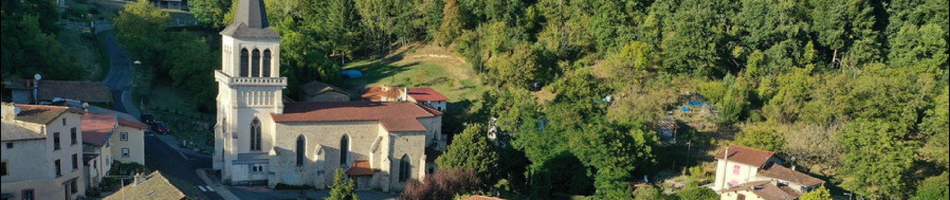
Escoutoux_Coteaux

jagarnier
User GUIDE
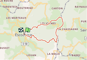

Length
6.8 km

Max alt
727 m

Uphill gradient
367 m
Km-Effort
11.7 km

Min alt
382 m

Downhill gradient
365 m
Boucle
Yes
Creation date :
2019-12-25 14:58:23.365
Updated on :
2025-04-20 12:25:41.212
2h00
Difficulty : Medium

FREE GPS app for hiking
 SityTrail
IGN / Geographical institutes
SityTrail Plus
The world is yours!
About
Trail Walking of 6.8 km to be discovered at Auvergne-Rhône-Alpes, Puy-de-Dôme, Escoutoux. This trail is proposed by jagarnier.
Photos

Positioning
Country:
France
Region :
Auvergne-Rhône-Alpes
Department/Province :
Puy-de-Dôme
Municipality :
Escoutoux
Location:
Unknown
Start:(Dec)
Start:(UTM)
543814 ; 5074142 (31T) N.
Comments