


Olmet_Ruisseaux

jagarnier
User GUIDE
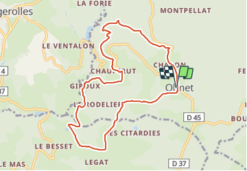

Length
9.4 km

Max alt
648 m

Uphill gradient
296 m
Km-Effort
13.3 km

Min alt
445 m

Downhill gradient
296 m
Boucle
Yes
Creation date :
2019-12-26 17:36:08.946
Updated on :
2023-06-27 07:44:51.989
2h45
Difficulty : Medium

FREE GPS app for hiking
 SityTrail
IGN / Geographical institutes
SityTrail Plus
The world is yours!
About
Trail Walking of 9.4 km to be discovered at Auvergne-Rhône-Alpes, Puy-de-Dôme, Olmet. This trail is proposed by jagarnier.
Description
Un circuit varié alliant des ruisseaux à des sites pittoresques comme des moulins ou des rochers druidiques.
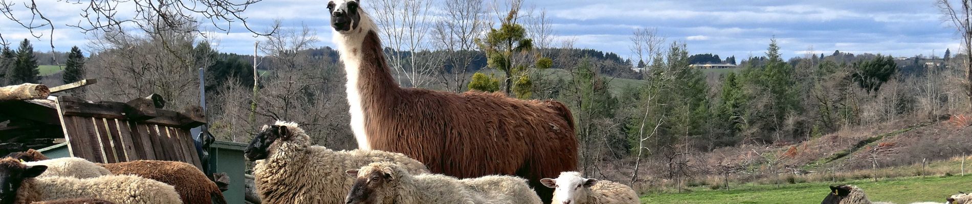
Photos

Positioning
Country:
France
Region :
Auvergne-Rhône-Alpes
Department/Province :
Puy-de-Dôme
Municipality :
Olmet
Location:
Unknown
Start:(Dec)
Start:(UTM)
551435 ; 5062036 (31T) N.
Comments
