Trail Walking Olmet - Olmet_Ruisseaux - Photo
 jagarnier
jagarnier

User GUIDE

© OpenStreetMap contributors
Length
Length
9.4 km
Max alt
Max alt
648 m
Uphill gradient
Uphill gradient
296 m
Km-Effort
Km-Effort  
13.3 km
Min alt
Min alt
445 m
Downhill gradient
Downhill gradient
296 m
Boucle
Boucle
Yes
Creation date :
2019-12-26 17:36:08.946
Updated on :
2023-06-27 07:44:51.989

(1 Reviews)

Walking
Walking
2h45
Difficulty : Medium

Scan this QR Code to open this trail in the SityTrail application

FREE GPS app for hiking

Logo SityTrail SityTrail

IGN / Geographical institutes

Download SityTrail from the App Store Download SityTrail from Google Play

Logo SityTrail SityTrail World

The world is yours!

Download SityTrail from the App Store Download SityTrail from Google Play Download SityTrail on Huawei AppGallery

About

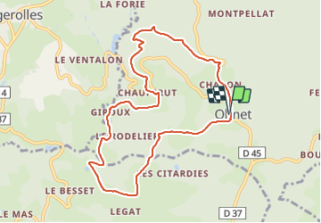
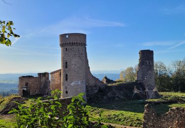
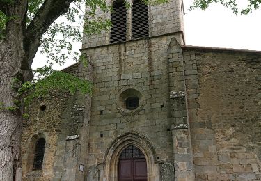
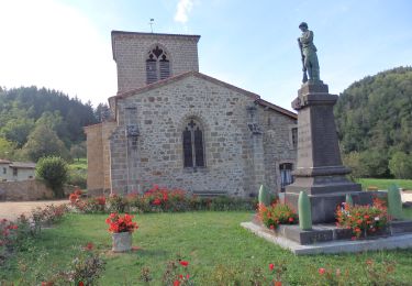
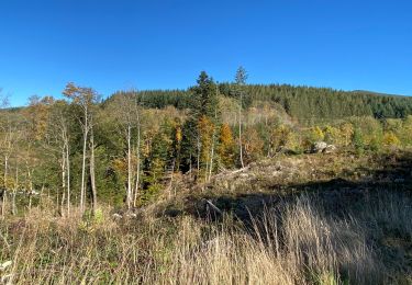
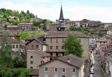
Trail Walking of 9.4 km to be discovered at Auvergne-Rhône-Alpes, Puy-de-Dôme, Olmet. This trail is proposed by jagarnier.

Description

Un circuit varié alliant des ruisseaux à des sites pittoresques comme des moulins ou des rochers druidiques.

Elevation profile

Photos

Positioning

Country:
France
Region :
Auvergne-Rhône-Alpes
Department/Province :
Puy-de-Dôme
Municipality :
Olmet
Location:
Unknown
Start:(UTM)
551435 ; 5062036 (31T) N.

Comments

Please log in to post a review or rate the element


Trails nearby

Trail On foot Marat - Saint-James - Photo
On foot
PRO

On foot

Easy
Marat, Auvergne-Rhône-Alpes, Puy-de-Dôme, France
3.3 km | 5.5 km-effort
1h 14min
Yes
Trail On foot Marat - Le Communal de Rucheix - Photo
On foot
PRO

On foot

Easy
Marat, Auvergne-Rhône-Alpes, Puy-de-Dôme, France
8.1 km | 12.2 km-effort
2h 46min
Yes
Trail Walking Olmet - Olmet_Chateau_Faye_ADV - Photo
Walking
GUIDE
jagarnier

Walking

Medium
Olmet, Auvergne-Rhône-Alpes, Puy-de-Dôme, France
12.4 km | 18.5 km-effort
3h 45min
Yes
Trail Walking Olmet - Olmet_Chateau-de-la-Faye_T - Photo
Walking
force

Walking

Very difficult
Olmet, Auvergne-Rhône-Alpes, Puy-de-Dôme, France
12.9 km | 19.2 km-effort
3h 6min
Yes
Trail On foot Olmet - Le Chateau de la Faye - Photo
On foot
PRO

On foot

Easy
Olmet, Auvergne-Rhône-Alpes, Puy-de-Dôme, France
11.2 km | 16.8 km-effort
3h 49min
No
Trail On foot Saint-Gervais-sous-Meymont - Autour de la Maison du Parc - Photo
On foot
PRO

On foot

Easy
Saint-Gervais-sous-Meymont, Auvergne-Rhône-Alpes, Puy-de-Dôme, France
12.1 km | 18.8 km-effort
4h 16min
No
Trail Walking La Renaudie - Le circuit des ponts - Photo
Walking
boulinevelyne

Walking

Medium
La Renaudie, Auvergne-Rhône-Alpes, Puy-de-Dôme, France
26 km | 37 km-effort
6h 55min
Yes
Trail Walking Olliergues - Olliergues_Chabasse - Photo
Walking
GUIDE
jagarnier

Walking

Medium
Olliergues, Auvergne-Rhône-Alpes, Puy-de-Dôme, France
13.9 km | 20 km-effort
4h 13min
Yes
Trail Walking Le Brugeron - 4ieme jour col du beal - Photo
Walking
jpdroux

Walking

Very difficult
Le Brugeron, Auvergne-Rhône-Alpes, Puy-de-Dôme, France
22 km | 33 km-effort
5h 55min
No


Close
My subscriptions