


Holsbeek

JanBekaert
User
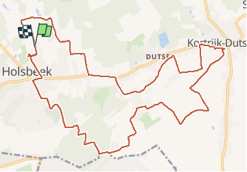

Length
15 km

Max alt
85 m

Uphill gradient
145 m
Km-Effort
16.9 km

Min alt
12 m

Downhill gradient
144 m
Boucle
Yes
Creation date :
2019-12-29 07:00:44.695
Updated on :
2019-12-29 11:30:39.728
4h27
Difficulty : Very easy

FREE GPS app for hiking
 SityTrail
IGN / Geographical institutes
SityTrail Plus
The world is yours!
About
Trail Walking of 15 km to be discovered at Flanders, Flemish Brabant, Holsbeek. This trail is proposed by JanBekaert.
Positioning
Country:
Belgium
Region :
Flanders
Department/Province :
Flemish Brabant
Municipality :
Holsbeek
Location:
Holsbeek
Start:(Dec)
Start:(UTM)
623641 ; 5643021 (31U) N.
Comments