


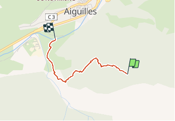
20191229 Descente ski rando

motardes04
User

Length
2.1 km

Max alt
1992 m

Uphill gradient
0 m
Km-Effort
3.9 km

Min alt
1446 m

Downhill gradient
540 m
Boucle
No
Creation date :
2019-12-29 12:04:00.483
Updated on :
2019-12-29 12:47:55.432
43m
Difficulty : Easy

FREE GPS app for hiking
 SityTrail
IGN / Geographical institutes
SityTrail Plus
The world is yours!
About
Trail Touring skiing of 2.1 km to be discovered at Provence-Alpes-Côte d'Azur, Hautes-Alpes, Aiguilles. This trail is proposed by motardes04.
Positioning
Country:
France
Region :
Provence-Alpes-Côte d'Azur
Department/Province :
Hautes-Alpes
Municipality :
Aiguilles
Location:
Unknown
Start:(Dec)
Start:(UTM)
332021 ; 4959947 (32T) N.
Comments