


navacelle

marcagif
User
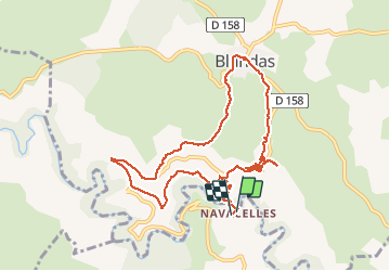

Length
11.3 km

Max alt
669 m

Uphill gradient
401 m
Km-Effort
16.6 km

Min alt
326 m

Downhill gradient
398 m
Boucle
Yes
Creation date :
2019-12-29 11:32:18.65
Updated on :
2019-12-29 16:32:34.381
3h38
Difficulty : Very easy

FREE GPS app for hiking
 SityTrail
IGN / Geographical institutes
SityTrail Plus
The world is yours!
About
Trail Walking of 11.3 km to be discovered at Occitania, Hérault, Saint-Maurice-Navacelles. This trail is proposed by marcagif.
Positioning
Country:
France
Region :
Occitania
Department/Province :
Hérault
Municipality :
Saint-Maurice-Navacelles
Location:
Unknown
Start:(Dec)
Start:(UTM)
541075 ; 4860277 (31T) N.
Comments