


le lioran 30 12 2019 marche et raquettes

marcagif
User
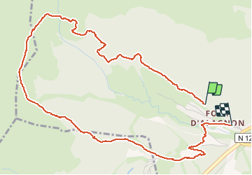

Length
6.3 km

Max alt
1549 m

Uphill gradient
302 m
Km-Effort
10.5 km

Min alt
1197 m

Downhill gradient
355 m
Boucle
No
Creation date :
2019-12-30 12:02:24.149
Updated on :
2019-12-30 14:36:01.457
2h33
Difficulty : Very easy

FREE GPS app for hiking
 SityTrail
IGN / Geographical institutes
SityTrail Plus
The world is yours!
About
Trail Walking of 6.3 km to be discovered at Auvergne-Rhône-Alpes, Cantal, Laveissière. This trail is proposed by marcagif.
Positioning
Country:
France
Region :
Auvergne-Rhône-Alpes
Department/Province :
Cantal
Municipality :
Laveissière
Location:
Unknown
Start:(Dec)
Start:(UTM)
479505 ; 4992983 (31T) N.
Comments